To ensure good planning goes into accessways to land parcels, survey plans (land maps) must be provided to infrastructure managers when the Court is laying out or varying a right of way and when preparing a partition order. The infrastructure managers are Te Aponga Uira (TAU), To Tatou Vai (TTV), Vodafone and Infrastructure Cook Islands (ICI). ICI is the road manager while the other agencies provide electricity, water and telecommunications.
This process is legislated for under a 2019 amendment to the Cook Islands Act 1915.
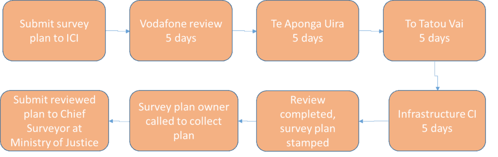
Hand in your original survey plan (with surveyors stamp and signature) to ICI who will then circulate the map amongst the rest of the infrastructure managers. No application form or documents are needed. If a right of way is changing or a partition order is underway, the Court will apply to ICI with additional documentation.
The infrastructure managers are allowed 20 days, 5 days each, to review the survey plan and the location. This process helps infrastructure managers’ plan for the provision of their cables and pipes. ICI will check the site and ensure the proposed accessway is in the most suitable location. This is especially important on inland, sloping lands and is necessary to reduce the occurrence of accessways being formed side by side.
See flow diagram for the process.
A development guide is handed to applicants upon collection of their reviewed map. This guide provides advice to think about for your development and provides a guide through the permitting process and connection to utilities. Download the guide here.
For information on how to apply for land, visit the Ministry of Justice website.