Infrastructure Cook Islands houses planning functions under the Projects and Implementation Division and a National Hydrography and Geoscience Division.
Geoscience (Mapping and Data)
Infrastructure Cook Islands National Hydrography and Geoscience Division plays a crucial role in economic and sustainable development through its diverse range of activities and collaborations with National and Regional Organizations. They contribute to project management and decision-making, civil engineering, emergency disaster management, climate change adaptation, asset development and information, land natural resource management, surveying, transportation, infrastructure, health, agriculture, marine activities, nautical charting and maritime zone information.
Infrastructure development projects with our various Divisions and Cook Islands Investment Corporation (CIIC) to name a few examples, rely on our knowledge and data resources. Whether it is planning new construction projects, upgrading existing infrastructure or optimizing transportation networks, our geospatial information plays a crucial role in informing decision-makers, minimizing environmental impacts and maximizing the long-term sustainability of development initiatives.
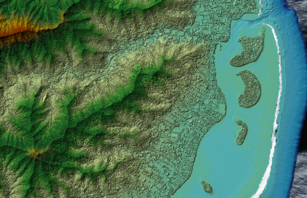
Digital surface model of Ngatangiia
In the area of disaster management, we work closely with Emergency Management Cook Islands (EMCI), providing essential geospatial data that is instrumental in disaster planning, response and recovery efforts. This includes providing building information, mapping vulnerable areas, assessing risks, facilitating informed decision-making to enhance the islands’ resilience to natural hazards such as cyclones, sea surges and flooding.
We collaborate with the National Environment Service (NES) by sharing geospatial data on our environment, ecosystems and natural resources, to support NES in monitoring environmental health, identifying conservation priorities and implementing effective management strategies to safeguard biodiversity and mitigate environmental degradation.
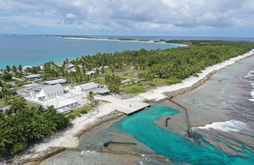
Tauhunu Harbour, Manihiki
Avaavaroa passage bathymetry
Ensuring safe navigation and maritime operations is another key area where we contribute our resources. Through collaboration with the Ministry of Transport (MOT) and contractors, we organize hydrographic surveys to map coastal waters and passages, identify navigational hazards, and enhance
Our involvement extends beyond national borders through partnerships with regional organizations such as the Secretariat of the Pacific Community (SPC) and the Secretariat of the Pacific Regional Environment Programme (SPREP). By participating in collaborative mapping projects and training knowledge-sharing initiatives, we contribute to broader efforts aimed at addressing common challenges and promoting sustainable development across the Pacific region.
The National Hydrography and Geoscience Division have three focus areas below:
Geodetic surveying in the Cook Islands focuses on establishing precise control points, determining the Earth’s shape, measuring distances and angles, defining geodetic datums and coordinate systems, and establishing vertical datums for elevation data. These support infrastructure development by providing accurate mapping and data essential for sustainable growth and infrastructure projects across the islands.
Hydrography
Hydrography involves the study and measurement of bodies of water, such as oceans, seas, lakes, and rivers. It focuses on mapping and charting the physical features, tides, currents, and depths of these water bodies to ensure safe navigation, efficient use of marine resources, and protection of coastal environments.
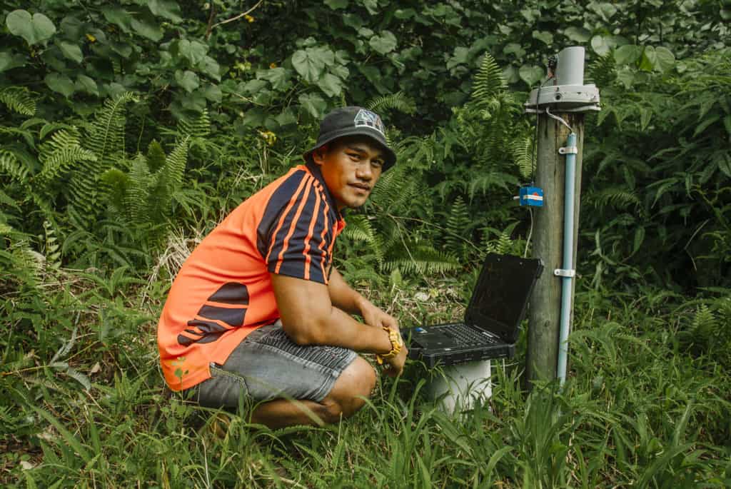
Our hydrographer will soon be carrying out hydrographic surveying to improve safety navigation at Avatiu Port.
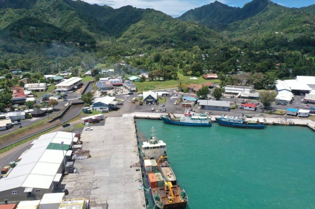
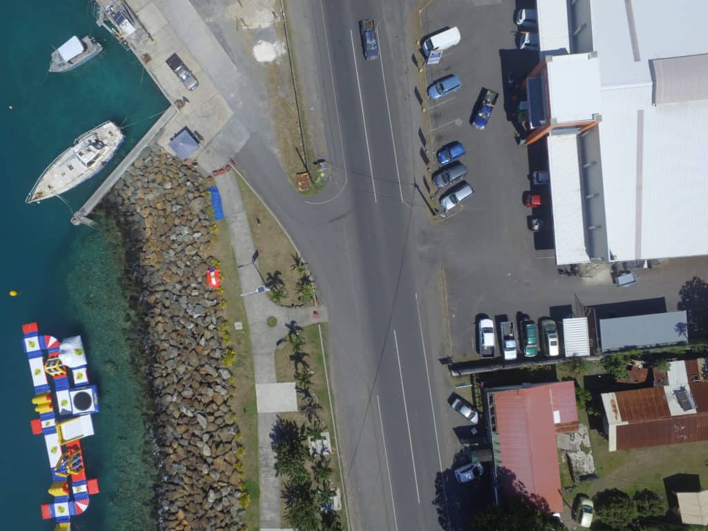
Avatiu Harbour, Rarotonga
Geospatial information
Geospatial information is geography and mapping which is ‘place based’ or ‘locational’ information. ICI has for many years provided the technical expertise in Geospatial information to other agencies and stakeholders. As a result, ICI is the implementing agency for Government’s Spatial Information Management Policy, which was endorsed by Cabinet in 2020.
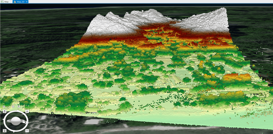
GIS (Geographic Information System) is a vital tool utilized by the division. GIS technology enables the capture, storage, analysis, management, and visualization of geospatial data. It allows for the integration and overlaying of various layers of information, such as hydrographic, land, infrastructure and transportation data, to support informed decision-making processes. One important upcoming resource is LiDAR (Light Detection and Ranging) data, a remote sensing technology that uses laser light to measure distances and generate highly accurate three-dimensional representations of the Earth’s surface – which is used extensively and in combination with GIS.
LiDAR image of a section of Rarotonga
Recent and upcoming National Hydrography and Geoscience Projects
Collate/update Geospatial Datasets in CookGeoPortal to ensure access, sharing, security and collaboration
LiDAR Phase 2: Reviews, Analysis, Data extraction, Generating GIS feature classes and layers, Training, Demos, Modelling in relation to coastal inundation and flooding hazards
Develop Geospatial Surveying Strategy and Standards
Modernise Cook Islands Geodetic Reference Frame
Hydrographic surveying to improve safety navigation in Port, Harbour Areas